Hiking Trails in the Estérel: Our Favourite Routes Around Théoule-sur-Mer
Which hike is right for you?
| Route | Difficulty | Distance | Time | Best for |
|---|---|---|---|---|
| Col de Théoule – Piste du Soleil d’Or | 🟢 Easy | 3.5 km | 1 h | Families & an easy outing |
| Mont Turney – Riou de l’Argentière | 🟡 Moderate | 7.1 km | 1 h 45 | A shorter nature walk |
| Col de Théoule – Col des Monges – Collet de l’Autel | 🟡 Moderate | 8.4 km | 2 h 30 | A scenic half-day hike |
| Three Passes Circuit | 🟡 Moderate | 14 km | 4 h 20 | A longer half-day adventure |
| Monges & Grues Circuit | 🔴 Hard | 17.5 km | 5–6 h | Experienced hikers |
| Trayas – Mandelieu-la-Napoule | 🔴 Hard | 20.9 km | 7 h | Long-distance walkers |
| Grosses Grues & Cap Roux | 🔴 Hard | 27 km | 8½ h | A challenging full day |
| La Napoule – Col des Trois Termes – Sommets des Grues | 🔴 Hard | 41.5 km | Multi-day | Experienced long-distance hikers |
| La Napoule – Estérel Forest – Maubois Cove | 🔴 Hard | 49.4 km | Multi-day | Serious hiking adventures |
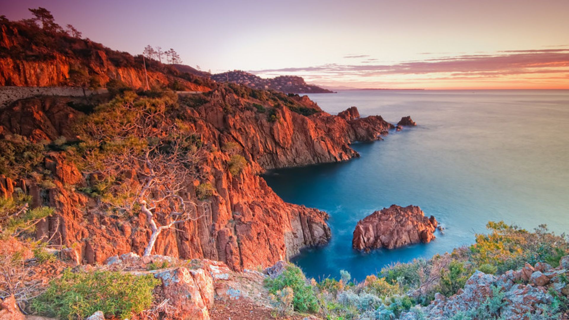
The Estérel is one of the most spectacular hiking areas on the French Riviera. Its combination of deep red volcanic rocks, fragrant pine forests, hidden valleys and brilliant blue Mediterranean views makes walking here feel quite different from hiking elsewhere on the Côte d’Azur.From an easy one-hour walk with an extraordinary panorama to demanding full-day routes crossing several mountain passes, there is a trail for almost every level of hiker.And if you are staying in Théoule-sur-Mer, you are in a particularly good position: some of the most beautiful trails in the Estérel begin practically on your doorstep.Here are nine routes to consider, ranging from a gentle outing to serious challenges for experienced hikers.
1. Monges & Grues Circuit
Hard • 17.5 kmStarting point: Parking du Vallon de l’Autel, Théoule-sur-MerThis challenging circuit takes you deep into the dramatic landscapes of the Estérel, climbing from the hills above Théoule and crossing several mountain passes.The trail leads through the characteristic red rocks of the massif, with spectacular views opening up over the Mediterranean as you gain altitude. On clear days, you can see towards the Pre-Alps and the Mercantour mountains.It is a demanding hike, but the scenery makes the effort worthwhile. Towards the end of winter, the hillsides can also be covered in the brilliant yellow flowers of the mimosa, one of the great seasonal pleasures of the Estérel.Allow: approximately 5–6 hours, depending on your pace and conditions.
Best for: experienced hikers looking for a proper day in the mountains.Important: access around the Vallon de l’Autel and its DFCI tracks can be subject to restrictions, particularly during periods of fire risk or forestry works. Check current access conditions before setting off.
2. Col de Théoule – Col des Monges – Collet de l’Autel
Moderate • 8.4 km • approx. 2 h 30Starting point: Parking du Vallon de l’Autel, Théoule-sur-MerThis is a lovely introduction to hiking around Théoule and a good choice if you want something more substantial than a short stroll without committing to a full-day hike.The circular route climbs through the hills above Théoule, passing the Col de Théoule, Col des Monges and Collet de l’Autel. The landscape alternates between pine forest, rocky terrain and open viewpoints over the Mediterranean.It is also a popular area for mountain biking, so keep an eye out for cyclists on shared sections of the trail.Come towards the end of winter and you may find the mimosa in bloom, filling the hills with colour and its distinctive fragrance.Allow: around 2½ hours.
Best for: reasonably fit walkers who want beautiful scenery without an all-day commitment.Important: as with the longer Monges routes, check current access restrictions around Vallon de l’Autel before starting.
3. The Three Passes Circuit
Moderate • 14 km • approx. 4 h 20Starting point: Vallon de l’Autel area, Théoule-sur-MerThe name gives away the main attraction: this route takes you across three of the Estérel's mountain passes — Col des Monges, Col du Trayas and Col de la Cadière.The circuit takes you through the characteristic landscape of the massif, with red rock formations, woodland and magnificent views towards the Mediterranean.At 14 kilometres, this is a proper half-day hike rather than a gentle walk, but the variety of scenery makes it particularly enjoyable.Allow: around 4½ hours.
Best for: hikers looking for a moderately challenging route with a good variety of scenery.As the route uses the network of trails around the heights of Théoule, check local access conditions before departure.
4. Col de Théoule – Piste du Soleil d’Or
Easy • 3.5 km • approx. 1 hourStarting point: Port de la Figueirette, Théoule-sur-MerThis is one of the easiest ways to enjoy the landscape of the Estérel without committing to a long hike.The route follows the Piste du Soleil d’Or from the Port de la Figueirette towards the Col de Théoule, climbing gently through the hills.At the Col de Théoule, at approximately 123 metres above sea level, you will find an orientation table and a wonderful panoramic viewpoint.The view is the real reward. On a clear day, the panorama stretches along the Mediterranean and across an extraordinary section of the French Riviera, with distant views towards Italy and Corsica.It is particularly beautiful in the early morning or towards sunset, when the light catches the red rocks of the Estérel.Allow: around 1 hour.
Best for: families, casual walkers or anyone wanting a short outing with a spectacular view.
5. Grosses Grues & Cap Roux
Hard • 27 km • approx. 8½ hoursStarting point: Plage de la Figueirette, Théoule-sur-MerThis is a serious hike for experienced walkers, but it is also one of the most rewarding routes in the area.Starting from Figueirette Beach, the trail heads into the Estérel, crossing several passes including Col de Théoule, Col des Monges and Col du Trayas.The route takes in impressive summits including Les Grosses Grues and the Cap Roux area, with magnificent views over the Mediterranean and the surrounding mountains.At 27 kilometres and more than eight hours on the trail, this is a full-day undertaking. Good fitness, proper footwear, plenty of water and an early start are essential.Allow: around 8½ hours.
Best for: experienced hikers looking for a challenging full-day adventure.
6. Trayas Station – Mandelieu-la-Napoule Station
Hard • 20.9 km • approx. 7 hoursStarting point: Gare du Trayas, Saint-Raphaël
Finish: Gare de Mandelieu-la-NapouleFor walkers who enjoy a long point-to-point route, this trail connects Le Trayas and Mandelieu-la-Napoule, crossing some of the beautiful and less crowded landscapes of the Estérel.At almost 21 kilometres, it is another demanding day in the mountains, with plenty of climbing and varied terrain.The great advantage of this route is that you do not have to return to your starting point. You can arrive by train at Le Trayas station and finish at Mandelieu-la-Napoule, making this one of the more practical long-distance hikes if you plan the journey carefully.The route is also used by mountain bikers, although its length and difficulty mean that it generally feels much quieter than the easier trails.Allow: around 7 hours.
Best for: experienced hikers who enjoy long-distance point-to-point routes.Check current train schedules before setting off, particularly if you are relying on public transport to return.
7. La Napoule – Col des Trois Termes – Sommets des Grues
Hard • 41.5 km • multi-dayStarting point: La Napoule, Mandelieu-la-NapouleNow we are entering serious hiking territory.This ambitious 41.5-kilometre route follows sections of the Balcons d’Azur through the Estérel, beginning in the La Napoule area and continuing through a succession of peaks, ridges and mountain passes.The route includes the Col des Trois Termes, the summits around Les Grosses Grues and the spectacular Rocher des Monges.This is not a casual afternoon walk. It is a route for experienced hikers who are comfortable with long distances, changing terrain and careful planning.For those who are, however, it provides a wonderful way to experience the Estérel away from the developed coastline and the more frequented viewpoints.Allow: multiple days.
Best for: experienced long-distance hikers and adventurous walkers.For a route of this length, make sure you have a detailed current map or GPX track rather than relying solely on the general trail description.
8. Mont Turney – Riou de l’Argentière
Moderate • 7.1 km • approx. 1 h 45Starting point: Mont Turney / San Peyre area, Mandelieu-la-NapouleIf you are looking for a shorter walk around Mandelieu-la-Napoule, this 7.1-kilometre loop is a good option.The route winds through wooded landscapes around Mont Turney and the Riou de l’Argentière, providing a pleasant combination of forest, open views and natural surroundings.It is considerably less demanding than some of the longer Estérel circuits, making it a good choice when you want to get out into nature without dedicating the entire day to hiking.Allow: around 1¾ hours.
Best for: a shorter outing and walkers looking for a moderate route.For this one, I would recommend checking the current trail map for the exact access/parking point before driving up, rather than relying on a generic “Mandelieu-la-Napoule” location.
9. La Napoule – Estérel Forest – Maubois Cove
Hard • 49.4 km • multi-dayStarting point: La Napoule, Mandelieu-la-NapouleFor serious walkers, this is the big one.The nearly 50-kilometre route crosses the Estérel from the La Napoule area through forest and mountain landscapes before reaching the beautiful Maubois Cove on the Mediterranean coast.It combines many of the things that make the Estérel so special: red rocks, dense woodland, mountain paths and glimpses of the sea appearing between the trees.Because of the distance and terrain, this is a route for experienced hikers who are properly equipped and prepared for a multi-day adventure.The reward is the feeling of getting properly away from the developed coastline and into the wilder side of the Estérel.Allow: multiple days.
Best for: experienced hikers looking for a serious Estérel adventure.For a hike of this length, use a current detailed map or GPX route and plan water, food and overnight arrangements in advance.
A few tips before heading into the Estérel
The Estérel may look gentle from the coast, but don't underestimate it. The combination of steep climbs, rocky paths and summer heat can make even a relatively short route surprisingly demanding.A few simple rules will make your day much more enjoyable:
- Take plenty of water, particularly between June and September.
- Wear proper hiking or walking shoes. Some paths are rocky and uneven.
- Start early in summer to avoid the strongest heat.
- Check the weather and trail conditions before setting off.
- Bring sun protection — there can be much less shade than you expect.
- Keep an eye on local forest-access restrictions during periods of high fire risk.
- Allow extra time if you want to stop for photographs, admire the views or simply sit on a rock and enjoy the silence.
- For longer routes, download the route or carry a current hiking map rather than relying on phone reception.
And don't forget your camera. The combination of the red Estérel rocks and intensely blue Mediterranean is one of the most photogenic landscapes on the entire French Riviera.
Hiking from Théoule-sur-Mer
One of the great pleasures of staying in Théoule is that you don't need to drive for an hour to find beautiful hiking.The hills behind the village lead directly into the Estérel, while coastal paths offer completely different scenery: tiny coves, dramatic cliffs, pine forests and views across the Mediterranean.Some walks begin close to Théoule itself, while others are easily reached by car or train from the neighbouring villages of Figueirette, Le Trayas and Mandelieu-la-Napoule.You can make a morning of it, return to the villa for lunch and a swim, or spend the whole day exploring the mountains.And after several hours walking through the Estérel, there is really only one appropriate ending: a swim in the Mediterranean followed by an aperitif overlooking the sea.That is what we call a successful hike on the French Riviera.